


The Jason-1's orbit
Jason-1's orbit is identical to that of Topex/Poseidon. It is optimized to study large-scale ocean variability and to provide coverage of 90% of the world's oceans over a ten-day cycle.
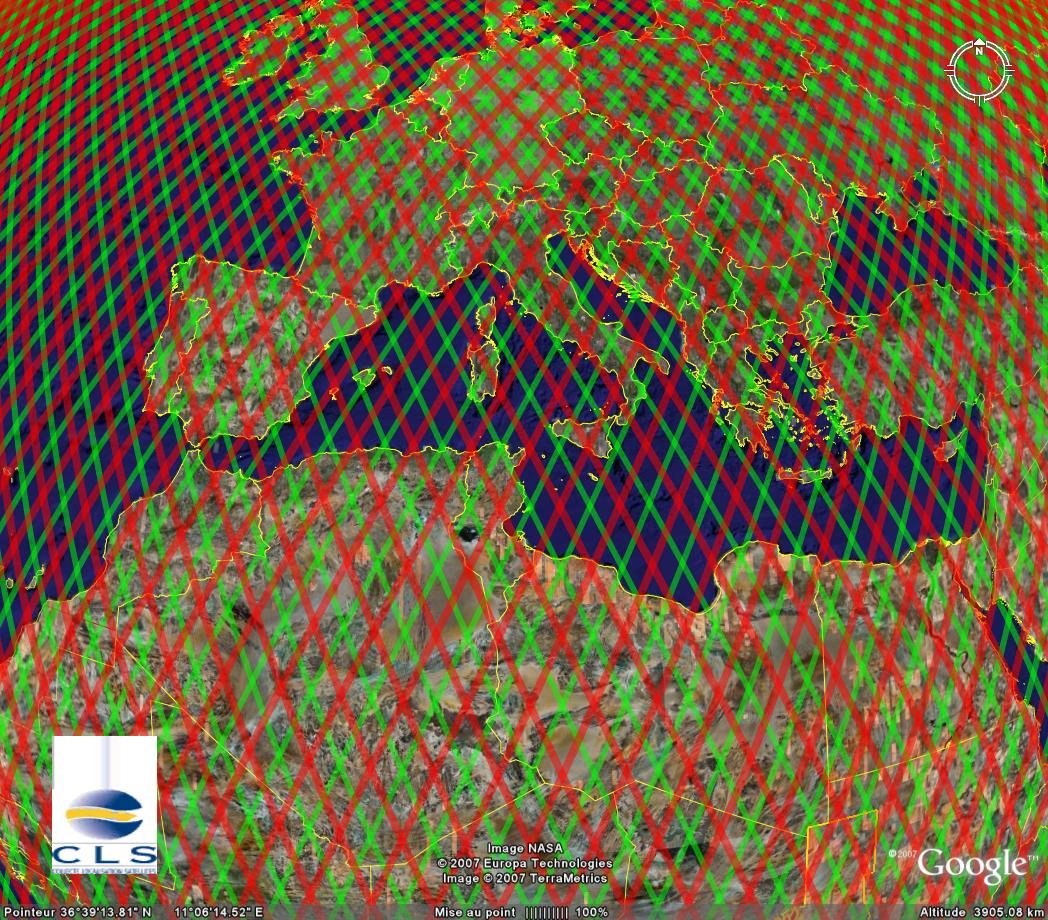
Jason-1 before February 2009 (red) and Topex/Poseidon (green) ground tracks on its new orbit on September 20, 2002. Download Google Earth files with <link fileadmin documents data tools visu_tpj1_tracks_ge_v3.kmz download>Jason-1 and <link fileadmin documents data tools visu_tp_interlaced_tracks_ge_v3.kmz download>Topex/Poseidon ground tracks or retreive all ground tracks here.
Choice of orbit
Jason-1's high altitude (1 336 kilometres) reduces interactions with the Earth's atmosphere and gravity field to a minimum, thus making orbit determination easier and more precise. The orbit inclination of 66 degrees North and South enables the satellite to cover most of the globe's unfrozen oceans. The orbit's repeat cycle is just under 10 days (9.9156 days to be precise, i.e. 10 days minus two hours) - in other words, the satellite passes over the same point on the Earth's surface (to within one kilometre) every ten days. This cycle is a trade-off between spatial and temporal resolution designed for the study of large-scale ocean variability. The fact that the orbit is prograde and not sun-synchronous also avoids aliasing of different tide components at the same frequency.
Furthermore, using the same orbit as Topex/Poseidon ensures better intercalibration and data continuity. The orbit is also designed to pass over dedicated ground calibration sites (Cap Senetosa in Corsica , the Harvest oil rig platform in California, USA,...).
Jason-1 has undergone an orbit change at the end of OSTM/Jason-2's calibration phase in February 2009. From 2008 to 2016, Jason-2 is located on the former orbit of Topex / Poseidon (before 2002) and Jason-1 (before February 2009). The Jason-1's orbit is shifted midway between its original ground tracks (corresponding to those of Topex/Poseidon after 2002). Jason-1 and OSTM/Jason-2 also have a time lag of 5 days. Two cycles (260-261) of Jason-1 science data were lost during the transit to the new tandem orbit phasing (26 Jan to 15 Feb, 2009).
After having encountered an anomaly at the end of February 2012 and early in March 2012, Jason-1 was in Safe Hold Mode (see chronology of these events at the bottom of this page). Cnes and Nasa management, through the Joint Steering Group, have directed the Jason-1 Project to begin a series of maneuvers to reduce the orbit on a drifting geodetic orbit at 1324.0 km.
Manoeuvres
A satellite's orbit parameters tend to change over time as a result of atmospheric drag. In the long term, more or less periodic variations also occur due to instabilities in the Earth's gravity field, solar radiation pressure and other forces of smaller magnitude.
Orbit maoeuvres are performed every 40 to 200 days. Intervals between manoeuvres depend chiefly on solar flux and each manoeuvre lasts from 20 to 60 minutes. Wherever possible, they are performed at the end of the orbit cycle, and above solid earth, so that lost data acquisition time is reduced to a minimum.
Orbit parameters
| Main characteristics | new geodetic orbit (>April 2012) | |
|---|---|---|
| Semi-major axis | 7714.4278 km | 7702.437 km |
| Eccentricity | 0.000095 | 1.3 to 2.8 10-4 |
| Inclination (non-sun-synchronous) | 66.039° | 66.042° |
| Auxiliary data | ||
| Reference altitude (equatorial) | 1 336 km | 1324 km |
| Nodal period | 6 745.72 seconds (112'42" or 1h52') | 6730s (1h52'10'') |
| Repeat cycle | 9.9156 days | |
| cycle | 406 days | |
| sub-cycles | 3.9 - 10.9 - 47.5 - 179.5 days | |
| Number of passes per cycle | 254 | 280 |
| Ground track separation at Equator | 315 km | |
| Acute angle at Equator crossings | 39.5° | |
| Longitude at Equator of pass 1 | 99.9242° | |
| Orbital velocity | 7.2 km/s | |
| Ground scanning velocity | 5.8 km/s |