


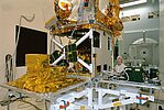
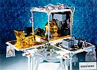
The platform and instruments
The Proteus spacecraft bus is the basic module accommodating the housekeeping instruments required for the satellite to function, as well as the dedicated mission instruments.
Proteus Platform
The generic Proteus bus, developed in partnership by Cnes and Thales Alenia Space, was used for the first time by Jason-1. The generic Proteus ground segment (control center and ground station) has also been specially adapted for Jason-1. It has been developed by Cnes to adapt to different minisatellites, thus cutting mission design costs (we can see it on Calipso, Corot, Smos and Jason-2 satellites).
Onboard instruments
Jason-1 is carrying a payload of five instruments : the Poseidon-2 altimeter, the mission's main instrument, which measures range; the JMR radiometer , which measures perturbations due to atmospheric water vapor; and three location systems : Doris, LRA et TRSR.
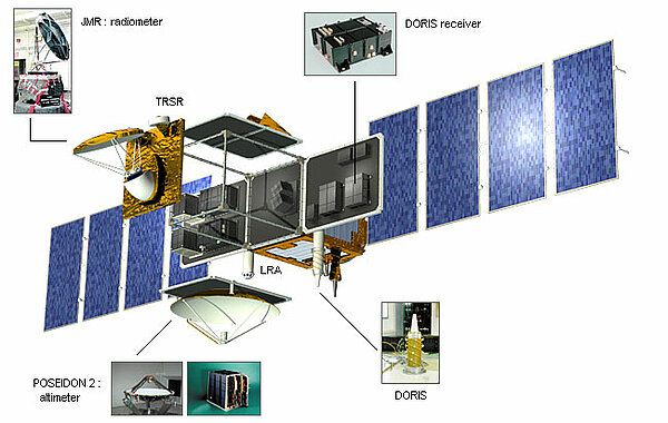
The Poseidon-2 altimeter
Poseidon-2 is the mission's main instrument, derived from the experimental Poseidon-1 altimeter on Topex/Poseidon. It is a compact, low-power, low-mass instrument offering a high degree of reliability. Poseidon-2 is a radar altimeter that emits pulses at two frequencies (13.6 and 5.3 GHz, the second frequency is used to determine electron content in the atmosphere) and analyzes the return signal reflected by the surface. The signal round-trip time is estimated very precisely to calculate the range, after applying corrections. (Instrument supplied by Cnes).
More information
The JMR radiometer
This instrument measures radiation from the Earth's surface at three frequencies (18.7, 23.8 and 34.0GHz). Measurements acquired at each frequency are combined to determine atmospheric water vapor and liquid water content. Once the water content is known, we can determine the correction to be applied for radar signal path delays. (Instrument supplied by Nasa).
More information
Location systems
The location systems onboard Jason-1 complement each other to measure the satellite's position on orbit to within two centimeters on the radial component.
The LRA is highly accurate but it requires ground stations that are complex to operate, and its use can be restricted by adverse weather conditions. It is used to calibrate the other two location systems so that the satellite orbit can be determined as accurately as possible. The TRSR (GPS) acquires data that complement Doris measurements to determine the orbit in real time and to support precise orbit determination.
Doris (Doppler location)
The Doris system uses a ground network of 50 orbitography beacons around the globe, which send signals at two frequencies to a receiver on the satellite. The relative motion of the satellite generates a shift in the signal's frequency (called the Doppler shift) that is measured to derive the satellite's velocity. These data are then assimilated in orbit determination models to keep permanent track of the satellite's precise position (to within three centimeters) on its orbit. (Instrument supplied by Cnes)
More information
TRSR (GPS location)
The TRSR uses the Global Positioning System (GPS) to determine the satellite's position by triangulation, in the same way that GPS fixes are obtained on Earth. At least three GPS satellites determine the mobile's exact position at a given instant. Positional data are then integrated into an orbit determination model to track the satellite's trajectory continuously. (Instrument supplied by Nasa)
More information
LRA (laser tracking)
The LRA is an array of mirrors that provide a target for laser tracking measurements from the ground. By analyzing the round-trip time of the laser beam, we can locate where the satellite is on its orbit. (Instrument supplied by Nasa)
More information